Skip to content
  • Home
  • Project
  • Schools
  • Families
  • Journeys
  • Contact us
  • English
    • Italiano
  • Home
  • Project
  • Schools
  • Families
  • Journeys
  • Contact us
  • English
    • Italiano
in progress
Completed, 
2020-2021

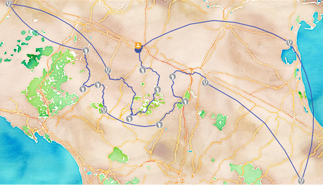
Discovering the protected areas of Emilia Romagna

1150 km in 
17 tappe
SEE THE ROUTE MAP
A journey to discover not only the naturalistic, historical and cultural beauties of the protected areas of Emilia Romagna, but also the priceless heritage of biodiversity of which they are custodians. A journey in stages from the Apennine ridge to the varied hilly and plain landscapes, up to the wetlands of the Po delta to understand the importance of protecting and conserving territories, landscapes, ecosystems in line with the objectives of the 2030 Agenda for Sustainable Development.
CEAS Emilia-Romagna
Istituto Rubiera (RE), 
Secondary School “E. Fermi”, 
Classes 1B+1G, 
A.S. 2020-2021.

I percorsi di viaggio di questa sezione sono coprogettati e sviluppati dalle classi insieme ai Ceas (Centri educazione alla sostenibilità) della rete regionale nell’ambito del progetto ‘La sostenibilità come processo di apprendimento’, finanziato da Regione Emilia-Romagna e Ministero Ambiente (MATTM), con l’obiettivo di facilitare la conoscenza e promuovere l’Agenda 2030 a scuola attraverso una didattica attiva e trasformativa, consapevole della dimensione sociale e costruttiva dei saperi e della complessità dei fattori che influiscono nei processi educativi. Questo in linea con le Linee guida ministeriali per l’educazione civica.

PrevNext routeProtected Areas of Emilia Romagna
Previews routeStep by step … through the Protected Areas of Emilia RomagnaNext

KidsGoGreen

Smart Cities
and Communities

Fondazione
Bruno Kessler
Via Sommarive, 18
I-38123 Povo (TN)

  • Project
  • Testimonials
  • Routes
  • For schools
  • For families
  • Login teachers
  • Login game management
  • Contacts
  • Privacy Policy
  • Climb project

Project by FBK ©

2025